
27th January 2026
One in six properties in England and Wales is considered at risk of flooding. Though this appears extensive, fewer than one-third of prospective buyers look into the flood risk of a listed property they’re considering.
As an engaged homeowner, you must ask the question, “Is my home at risk of flooding?” Fortunately, you can easily obtain this information using the flood risk map, the government flood risk check service and our helpful team here at Drainage Superstore. Our dedicated guide will explore the types of floods within the UK and the ways you can discover whether your home, current or future, is at risk of flooding. You can also check out our flood defence products to prepare for future flood risks.
Table of contents:
- Types of floods in the UK
- Which areas of the UK are most at risk from flooding?
- How can I find out if my house is in a flood risk area?
- What is a flood risk report for a house?
- Now you know how to find out if your house is at risk of flooding
Types of floods in the UK
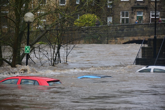
As flash floods become more common in the UK as a result of climate change, we tend to refer to all flooding as flash floods. This is a broad term that does not accurately describe all flooding situations. So, let’s take a closer look at the different types of flooding.
| Flood type | Description |
| River flooding (aka fluvial flooding) | Occurs when a river or stream overflows due to heavy rainfall. One of the most common forms of flooding in the UK. Can lead to widespread damage. |
| Coastal flooding (aka sea flooding) | Occurs when high tides, storm surges, and strong winds cause seawater to inundate coastal areas. |
| Surface water flooding (aka pluvial flooding) | Occurs when intense rainfall overwhelms drainage systems and causes water to accumulate on streets, roads, and other urban areas. |
| Groundwater flooding | Occurs when the water table rises due to persistent heavy rainfall, saturating the soil and causing groundwater to surface. Common in areas with a high water table. |
| Sewer flooding | Occurs when heavy rainfall overwhelms the drainage and sewage systems, causing sewage to back up into homes and streets. An unpleasant and hazardous type of flooding. |
| Flash flooding | Sudden, intense floods that occur with little warning, often as a result of heavy rainfall. Can be highly destructive and pose a significant risk to life and property. Especially dangerous after a long dry period since the ground is unable to absorb as much water as it normally might. |
| Reservoir flooding | Occurs if a dam or reservoir breaches, releasing a significant volume of water downstream. |
Historically, reservoir flooding has been a particularly lethal type, resulting in such disasters as the Great Sheffield Flood on 11 March 1864, which devastated large parts of the city and claimed the lives of at least 240 people.
However, there hasn’t been any recorded loss of life due to a reservoir or dam failure in the UK since 1925.
![]()
Which areas of the UK are most at risk from flooding?
Several areas of the UK are more susceptible to flooding due to a combination of factors, including geography, climate, and land use. Here’s what a breakdown of a UK flood risk map might look like.
East Anglia
Low-lying areas in East Anglia, particularly along the coast and river estuaries, are at significant risk of coastal and river flooding. Towns such as Great Yarmouth and Kings Lynn are particularly vulnerable.
Yorkshire and the Humber
The floodplain regions of the River Humber and its tributaries can experience severe flooding. Coastal areas along the North Sea might also be at risk.
Northwest England
Areas around the River Mersey, including parts of Greater Manchester and Liverpool, are river flood risk areas.
Southwest England
Coastal regions in the Southwest, especially South Devon and Cornwall, have been affected by severe coastal flooding in the past. Additionally, the Somerset Levels are known for their vulnerability to river flooding and are at significant surface water flood risk, making them a high flood risk area.
Wales
Low-lying areas along the coast and river valleys in Wales are prone to flooding. The beautiful coastal town of Aberystwyth is one such example.
Scotland
Coastal regions in Scotland, including areas around the Firth of Clyde, the Moray Firth and the River Tay, are at risk of coastal and river flooding.
Northern Ireland
Parts of Northern Ireland, including Belfast and regions around the River Lagan, are vulnerable to flooding, particularly areas close to the sea.

How can I find out if my house is in a flood risk area?
Using the Environment Agency’s flood risk map is the simplest method to determine whether your property is located in a long flood risk area. Keep in mind that the government uses the following four-level system to define flood zones.
| Flood Zone | Probability | Definition | Flood Map for Planning Colour |
| Flood Zone 1 | Low | <0.1% annual probability of river or sea flooding | Clear |
| Flood Zone 2 | Medium | 1% - 0.1% annual probability of river flooding 0.1% - 0.5% probability of sea flooding | Light blue |
| Flood Zone 3a | High | >1% annual probability of river flooding >0.5% probability of sea flooding | Dark blue |
| Flood Zone 3b* | Very high | >3.3% annual probability of flooding | Dark blue |
* This zone is also known as The Functional Floodplain and consists of land where river and/or coastal water has to flow in times of severe floods.
The relevant flood risk data is conveniently available online—although there are different websites for each home nation.
Here is a closer look at each of the available sites.
How to check if your home is in a high flood risk area in England
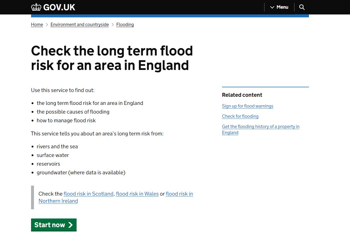
Step 1: Go to the flood risk map of England on the UK Government website.
Step 2: Click on Start now.
Step 3: Enter your postcode and click on ‘Continue’. Here you can also choose to view a map showing areas at risk of flooding.
Step 4: Select your address from the drop-down menu and click on Continue.
Step 5: You’ll get a Flood risk summary for the area around [your address] for various types of flooding.
Alternatively, you can call Floodline on 0345 988 1188.
How to check if your home is in a high flood risk area in Scotland
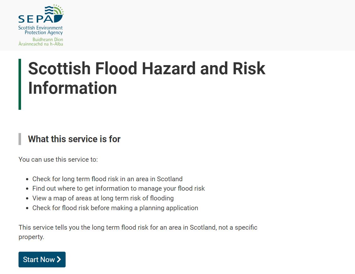
Step 1: Head over to Scottish Flood Hazard and Risk Information.
Step 2: Click on Start Now and accept the Terms & Conditions.
Step 3: Enter a full postcode in Scotland and click on Find Address. Here you can also choose to view a map showing areas at risk of flooding.
Step 4: Select your address from the drop-down menu and click on Next.
Step 5: You’ll get Flood Risk Information for your address for various types of flooding.
How to check if your home is in a high flood risk area in Wales
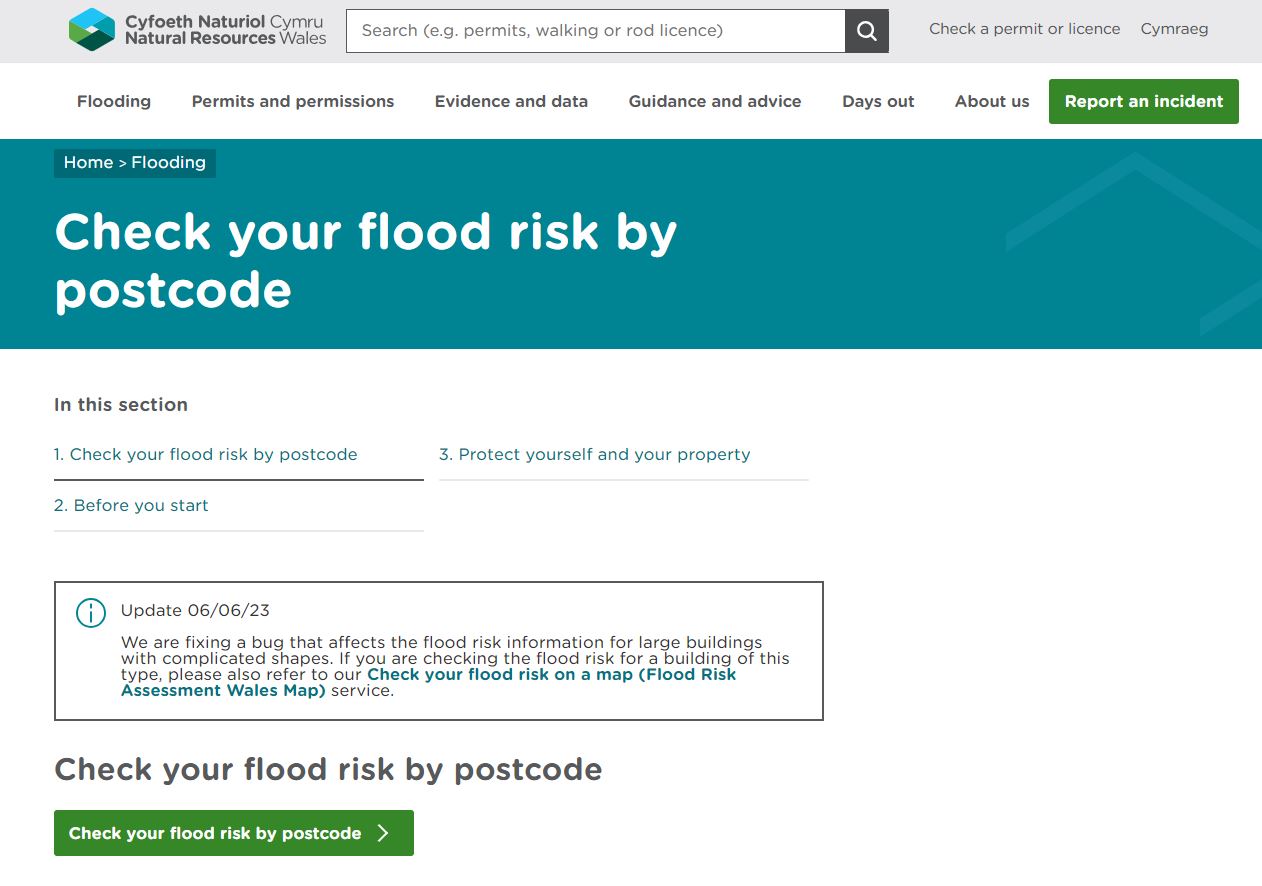
Step 1: Go to Natural Resources Wales.
Step 2: Click on Check your flood risk by postcode.
Step 3: Enter a postcode in Wales and click on the search icon. Alternatively, you can go straight to a map showing areas at high flood risk.
Step 4: You’ll get a summary of the flood risk for your chosen address.
How to check if your home is in a high flood risk area in Northern Ireland
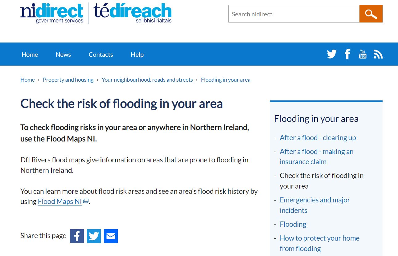
Step 1: Head over to the NI Direct Government Services flood risk checker.
Step 2: Click on the Flood Maps NI hyperlink.
Step 3: Under Viewing the Flood Maps, click on your preferred choice.
Step 4: Once you’ve agreed to the terms and conditions, you’ll be taken to an interactive map you can explore in detail.
What is a flood risk report for a house?
A ‘Flood Risk Report’ for a house is a document that provides detailed information about the potential flood risks associated with a specific property. It’s typically used by homeowners, homebuyers, and insurance companies to assess the flood risk of a property.
Your Flood Risk Report is likely to include the following:
- Flood Zone information
- Environmental agency data & flood maps from the relevant body:
- Environment Agency for England
- The Department of the Environment for Northern Ireland
- Natural Resources Body for Wales
- Scottish Environment Protection Agency
- Home insurance options
- Advice & recommendations
Bear in mind that these reports are typically obtained from specialist companies that collect and analyse flood risk data.
In addition, a Flood Risk Report should not be confused with a Flood Risk Assessment (FRA). Whereas an FRA is specifically related to the planning and development process, a Flood Risk Report relates to existing properties, including those considered for purchase.
To find out more about flood risk assessments, head over to our dedicated guide to learn when a flood risk assessment is required.
Now you know how to find out if your house is at risk of flooding
As climate patterns continue to shift, becoming more and more unpredictable, increased flood risk is a growing concern for many engaged homeowners in the UK. Luckily, there’s plenty of useful data available online to help you find out where your home is at serious risk of flooding.
Familiarise yourself with the Environment Agency flood risk map for your area, get your specific flood risk by postcode summary, contact your local council, and don’t forget to check out our Flood Hub for even more help and advice.
Was this guide useful?
Mentioned in this project guide:


